A report of my third day New Zealand: Auckland to Nelson
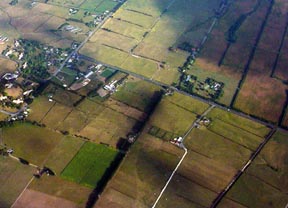
The trip from Auckland to Nelson was in a small turboprop
plane and lasted about 1 1/4 hours. After takeoff, the plane headed
southwest, passing over flat farmland given to truck crops and hay, and then
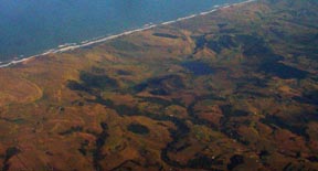
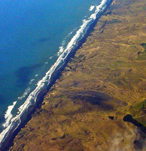
approached the coastline of the Tasman Sea. This section had a rougher
topography just behind the shoreline, and appeared to be quite dune-like,
covered with brownish grass. The surf looked great for the folks with surf
boards.
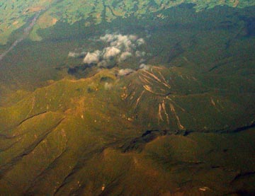
The plane's track then crossed the projecting Taranaki peninsula of the
southern part of the North Island, and flew over the dominant feature of Mt.
Taranaki, an extinct volcano that rises more than 2500 meters. As you can
see, it has a quite symmetrical cone, with a visible crater.
Leaving Mt. Taranaki behind the track moved out across South Taranaki Bight
of the Tasman Sea, heading for Nelson. The water here appeared extremely
rough, and I had the sense that there was a wind from the west really pushing
against a west-heading current.
As we approached
Nelson, it was possible to make out the outline of Farewell Spit, a hook-shaped
shallow sand bar that stretches east from Cape Farewell. This long sliver
of sand is a mecca for bird watchers, as it is populated in the New Zealand
summer by huge numbers of wading birds and shore birds that have migrated south
from the Arctic. It also is a regular site of whale strandings--particularly
Pilot Whales and Sperm Whales.
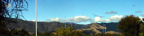
The landing at Nelson was smooth, and in a short while I had possession of
my rental car, and was pulling out of an airport that was much less busy than
Kennedy! The hills abutting the airport are clearly in management for
timber production, and are patchworks of clear-cut, juvenile, and mature timber
stands.
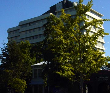 After
nursing the car along the "wrong" side of the road into the town of Nelson, I
found my hotel--The Rutherford--in the city center. It was easy to find,
as at about 9 stories high, it is clearly the tallest building in town.
(41o 16,544' S; 173o 16.899' E; Elevation = 54')
After
nursing the car along the "wrong" side of the road into the town of Nelson, I
found my hotel--The Rutherford--in the city center. It was easy to find,
as at about 9 stories high, it is clearly the tallest building in town.
(41o 16,544' S; 173o 16.899' E; Elevation = 54')
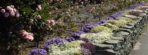
Just across the street from the hotel is a steep hill that is planted to
legions of flowers, and many specimens of large trees, including hoop pines,
cabbage palms, and a good sized California Redwood. The hill is
capped by a cathedral with a bell tower holding a chime.
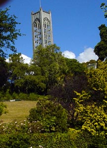
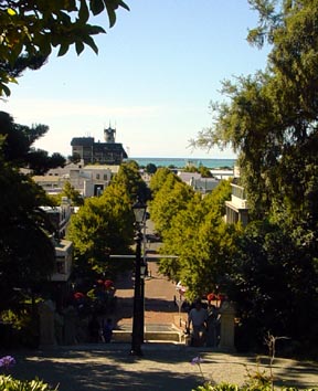
The view from the cathedral looks out over the town of Nelson to the Tasman
Bay. It is quite nice.
With plenty of time to look around, I drove east of the city to the base of
a remarkable formation known as "Boulder Bank." This bank of huge rounded
cobbles stretches for several miles, and encloses a large, very sheltered and
shallow bay, that was the reason the town of Nelson is located where it is.
The process of the formation of the boulder bank is not clear to me. It is
not a man-made structure, and its origins is discussed in some Maori legends.
The access to the bank is close to its eastern end, and the three pictures below show
it from looking west, then to the north, to the east.
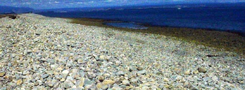
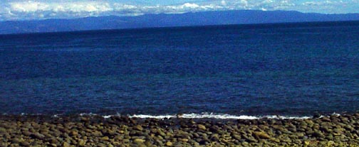
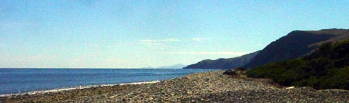
The distant hills in the center picture lie in the Abel
Tasman Park.
Back in Nelson, I visited an open air Saturday market, which
was quite festive, with lots of really nice vegetables and fruits, along with
some quality craft items, and many other things. I bought a bag of Biltong
(dried beef) for lunch, and had a nice chat with a gent selling old hand tools.
I almost bought a very nice Disston boxwood mortise gage, but decided it would
be foolish to lug it back halfway around the world! Finally, the day ended
with a trip to the local historical museum, which turned out to be very
informative and interesting with lots of information about the farming, mining, and manufacturing history
of Nelson and the surrounding region.
After a good meal of New Zealand Green Lip Mussels, and some
fish and chips, I expect to get a good night's sleep before moving on to
Kaikoura in the morning.