March 9 -- Stewart Island to Dunedin
Day l6
 At
8:30 am
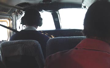
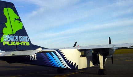
got on the plane safely—a larger one this time, two engines (at least it had two
propellers) and it held 8 passengers—there were only six of us on this trip, though. It was a
beautiful morning, and flight back to Invercargill was uneventful and quick—15
minutes. The luggage came right to us out of the plane, and I had no trouble
dealing with the automatic parking payment machine. So I was out of the airport
by 9am.
At
8:30 am
got on the plane safely—a larger one this time, two engines (at least it had two
propellers) and it held 8 passengers—there were only six of us on this trip, though. It was a
beautiful morning, and flight back to Invercargill was uneventful and quick—15
minutes. The luggage came right to us out of the plane, and I had no trouble
dealing with the automatic parking payment machine. So I was out of the airport
by 9am.
I wanted to take the “southern scenic route” to Dunedin in order to see the
Catlins coast. But the road was not well marked, and I found it only after
taking the wrong way twice—losing a half an hour. The road headed for the
coast, but passed by more sheep than I thought existed! The heavy rain a day or
two ago had greened up the paddocks (what they call sheep pastures), and washed
the sheared sheep clean so they looked white against the green grass. It was
quite striking.
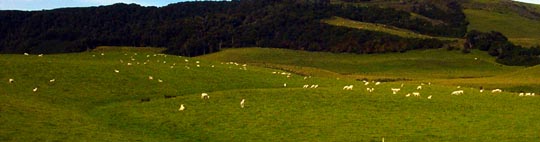
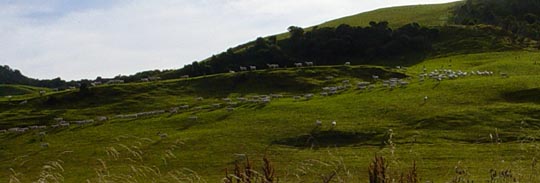
Two views of sheep on either side of the road. In the
lower picture, a dog is herding the sheep
The trout fishing guide, a few days ago, told me the going price at auction
for a good lamb is up around $100. So, when you see these huge paddocks of
sheep—literally thousands of them—you’re looking at a considerable sum of money.
The sheep are moved from paddock to paddock, and brought in for shearing,
crutching (you don’t want to know about that), dipping, and lambing using
herding dogs. I stopped a couple of times today to watch this. The dogs are
larger than Border Collies, and are black and brown, with fairly short hair.
They keep up a constant barking, a la our neighbor's dog, Glory, to move the sheep along.
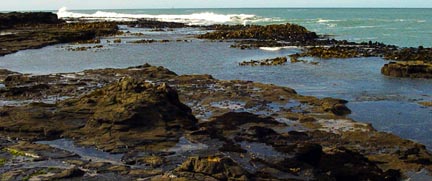
I dropped down to the coast for the first stop at Curio Bay, where there is
a fossilized Jurassic forest. The tide was indeed out, and I spent about an
hour walking about, taking some pictures and musing on the scene. The trees
were likely related to the Podocarps that now thrive in New Zealand. There were
no erect trees, of course, but lots of stumps and felled ones. According to the
info panels, there were at least three or four successive forests that developed
here, and were each felled by volcanic activity at intervals of 10,000 to 20,000
years. I think most of what is seen in the intertidal is early in the sequence,
with later ones found in the cliff layers that have not been eroded. It was
very interesting to me. Some of the visible trunks, that had been felled
before being buried, were more than 60 feet long—by my pacing. And in the layer
you can see, most of them are aligned in the same direction, suggesting a big
wind or volcanic blast felled them. I also saw a new bird on my trip here—a
Pied Stilt.
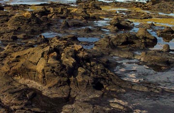
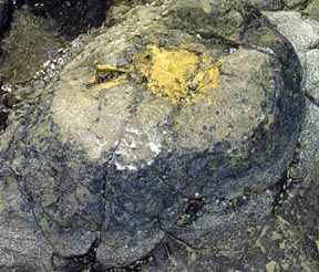
Boles, or stumps of the trees
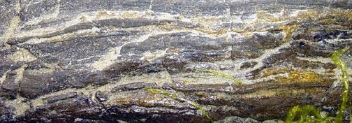
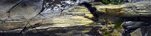
Parts of a felled logs
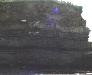
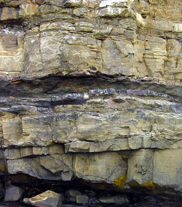
At the base of the cliffs around the perimeter of the bay, you
can clearly see successive strata of volcanic rock that encapsulate later
editions of a very similar forest.
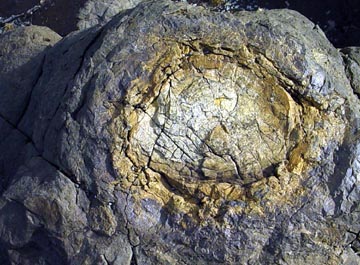
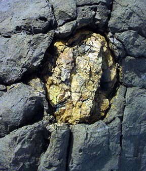
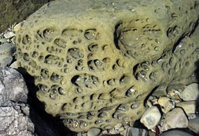
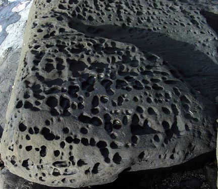
Widely scattered among the tree boles, are boulders that have
curious patterns of holes. Without further information, I'm guessing that
these are chunks of lava that are pocked with bubbles due to expanding hot gases
during their formation.
Most of this site is covered with water at high tides, and the
surf is impressive, even on a calm day. It seems a shame that surf erosion
goes unchecked, and that with every tide and storm there is loss of this unique
formation.
Back in the car, I went up to the camping area and at a little food stand
bought a beef and onion pie for lunch. It was pretty good, but on reading the
label, found it was “made in Australia”. Bummer!
After another half hour of driving, I stopped to see “Cathedral Caves”.
The hike down to the beach, and along
the beach to the cave was about 1.5 km, and was steeply downhill all the way.
The path was crowded with lots of waddling tourists, who looked like they would pay hell to get back up to
their cars.
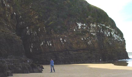
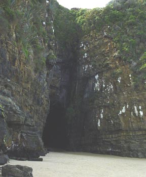
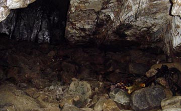
The cave(s) did not impress me very much. Just two big holes in a cliff
that had collapsed and the surf cleaned things out. You could walk in a couple
of hundred feet. I didn’t see a single crucifix, so don’t know why they call
the place a cathedral.
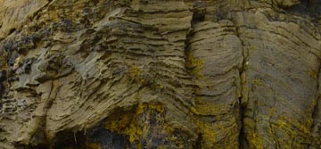
What was interesting were some layered rocks in the cliff adjacent to the
caves that appeared very similar in form to Pancake Rocks on the other side of
the island and somewhat north of here
The uphill walk back to the car was more interesting than difficult, since
the tree ferns were the largest I’ve seen, and I enjoyed identifying trees en
route.
From there I drove the final 100 km into Dunedin non-stop along Rte 1, which
was very busy. I got off the first real freeway I’ve seen at the Center City
exit, and drove a couple of blocks before I found a place to park and get my
bearings. Looking at the map, I found I was just two blocks from the hotel.
Like all the other places, they were expecting me, and the reception folks were
cordial. I can’t say enough about how smoothly all of the reservations have
gone. There hasn’t been one mixup yet (knock on wood).
Tomorrow I’m scheduled for a tour to the Otago Peninsula to see colonies of
breeding albatrosses, other sea birds, seals, and, hopefully, Yellow-Eyed
Penguins.